Austin 3D Photogrammetry
UT Austin Through Drone Scanning
Team: Shashank Kota, Ryan Hardesty Lewis
INTRODUCTION
Armed with a small grant, we purchased a DJI drone to capture high-resolution images of iconic Austin landmarks. With proper UT Austin permits in hand, we flew above structures like the UT Tower and William Darrell Stadium to produce detailed, geolocated 3D models—now viewable on an interactive Cesium map. Admittedly, scanning even a small area can take hours, so we’re working with a handful of highlights.
Our drone’s high-resolution camera captures overlapping imagery, essential for photogrammetry. We then process these images with specialized software to generate accurate 3D models. Manual geolocation and scaling ensure precise placements within the Cesium environment, bridging the gap between raw footage and an immersive digital experience.
3D MODELS
UT Tower
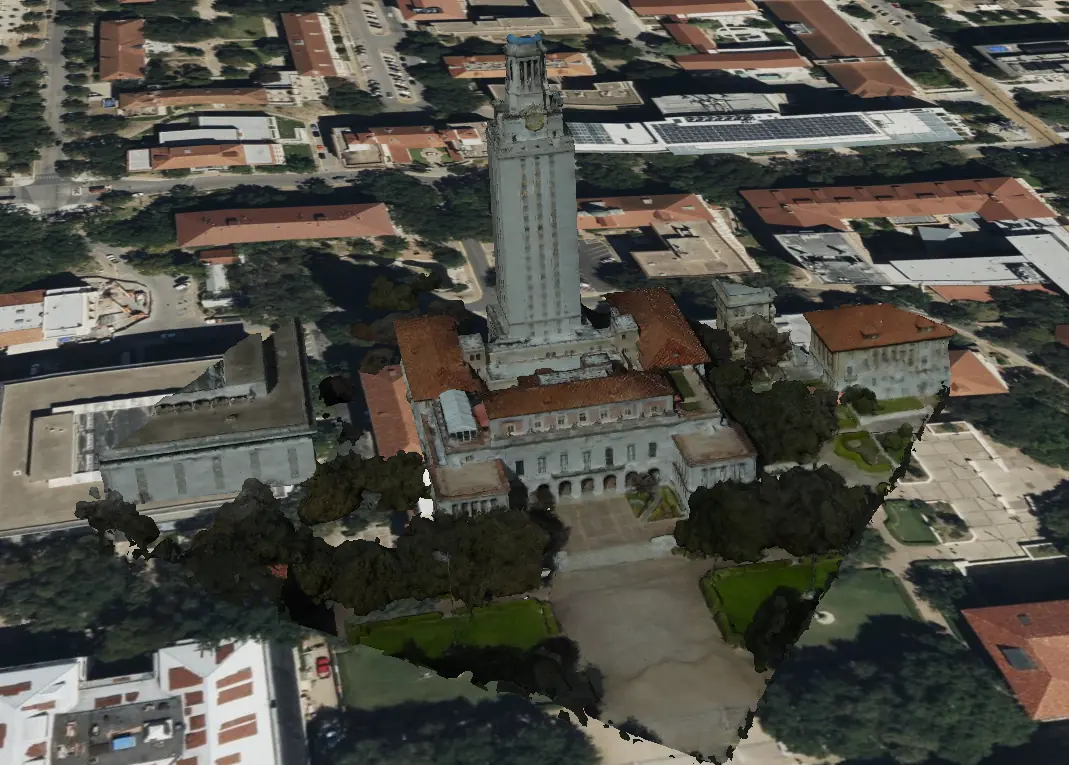
The UT Tower stands as a historic beacon for the University of Texas at Austin. Our 3D model offers an immersive perspective for virtual tours, architecture study, or just plain sightseeing from the comfort of your web browser.
William Darrell Stadium
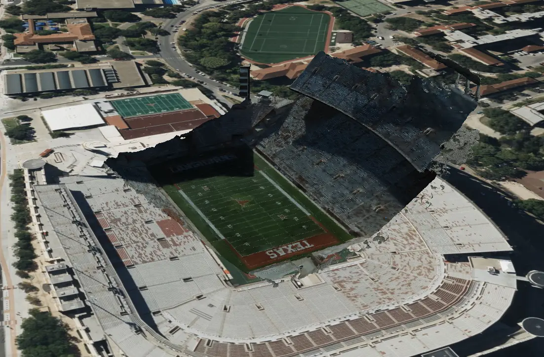
William Darrell Stadium hosts countless sports and community events. Our drone capture ironically covered just half the stadium. Still, the photogrammetry reveals a remarkable level of structural detail you can explore online.
INTERACTIVE EXPLORATION
Check out our integrated Cesium map for a hands-on experience of UT Austin in 3D. Zoom into specific landmarks, compare model fidelity, and imagine how even a few hours of drone scanning can capture a slice of academic history from above.
RESULTS & IMPACT
Through these 3D models—and the permit that made it possible—we’re paving the way for future drone-based captures of Austin’s ever-changing landscape. The results already show promise for urban planning, virtual tourism, and more. We also created a dedicated UT Austin 3D Virtual Tour project, extending the photogrammetry approach to promote digital exploration of the campus.
Looking ahead, we aim to expand our 3D repertoire, integrate real-time data, and refine user interaction—all to bolster Austin’s urban development and digital transformation initiatives.
ACKNOWLEDGEMENTS
Our heartfelt thanks to the University of Texas at Austin for permitting the drone flights, and to the Urban Information Lab for funding this endeavor. We’re also grateful to the CesiumJS team for their open-source platform that powers the interactive exploration of our 3D models.