VOXEL EARTH
Voxelizing Google Earth for New Virtual Worlds
INTRODUCTION
Voxel Earth is an innovative pipeline that automatically converts Google Maps Photorealistic 3D Tiles into voxels—making it possible to explore detailed, interactive worlds within platforms like Minecraft, web browsers, and virtual reality. By transforming high-resolution satellite imagery into fully navigable voxel-based landscapes, this approach bridges the gap between complex geographic data and immersive three-dimensional environments. The result is a scalable, accessible way to experience the planet, block by block.
INITIAL CONCEPT
The drive behind Voxel Earth was a desire to bring lifelike, voxel-styled representations of real-world locations into popular game or VR environments. Traditionally, such creations involved cumbersome methods of manually collecting and converting geographic data. By using Google’s Photorealistic 3D Tiles as our starting point, we could automate this process. The result? You can now explore detailed renditions of famous landmarks—or your own hometown—rendered in an interactive, voxelized style.
METHODOLOGICAL INNOVATIONS
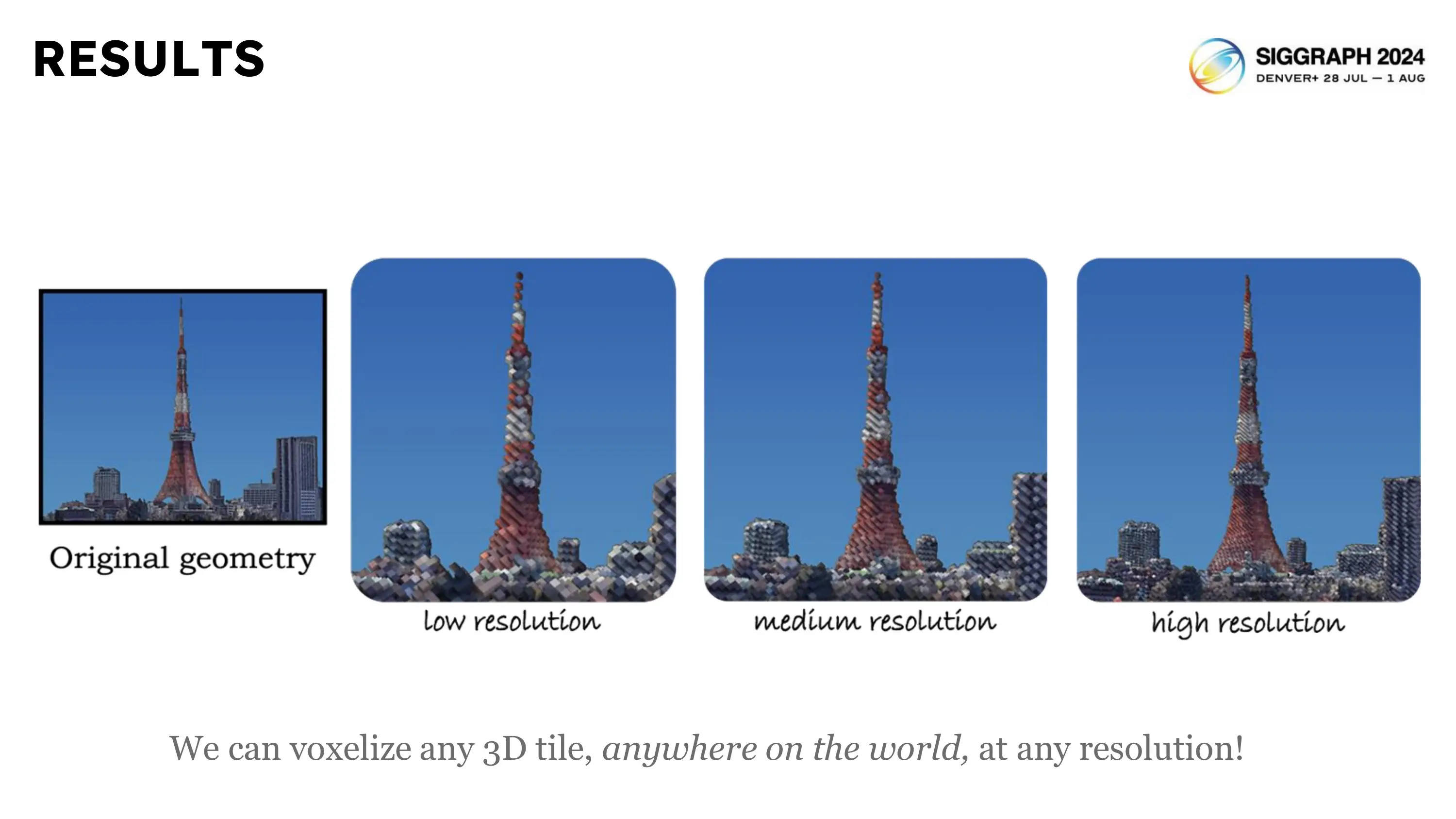
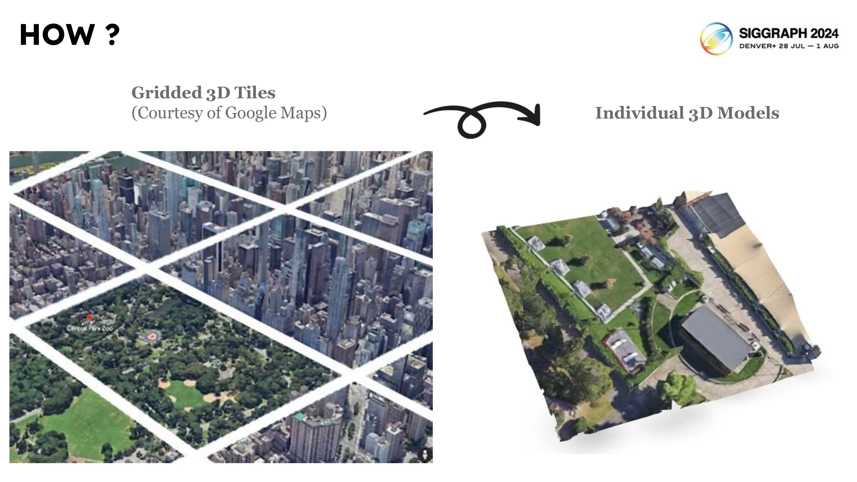
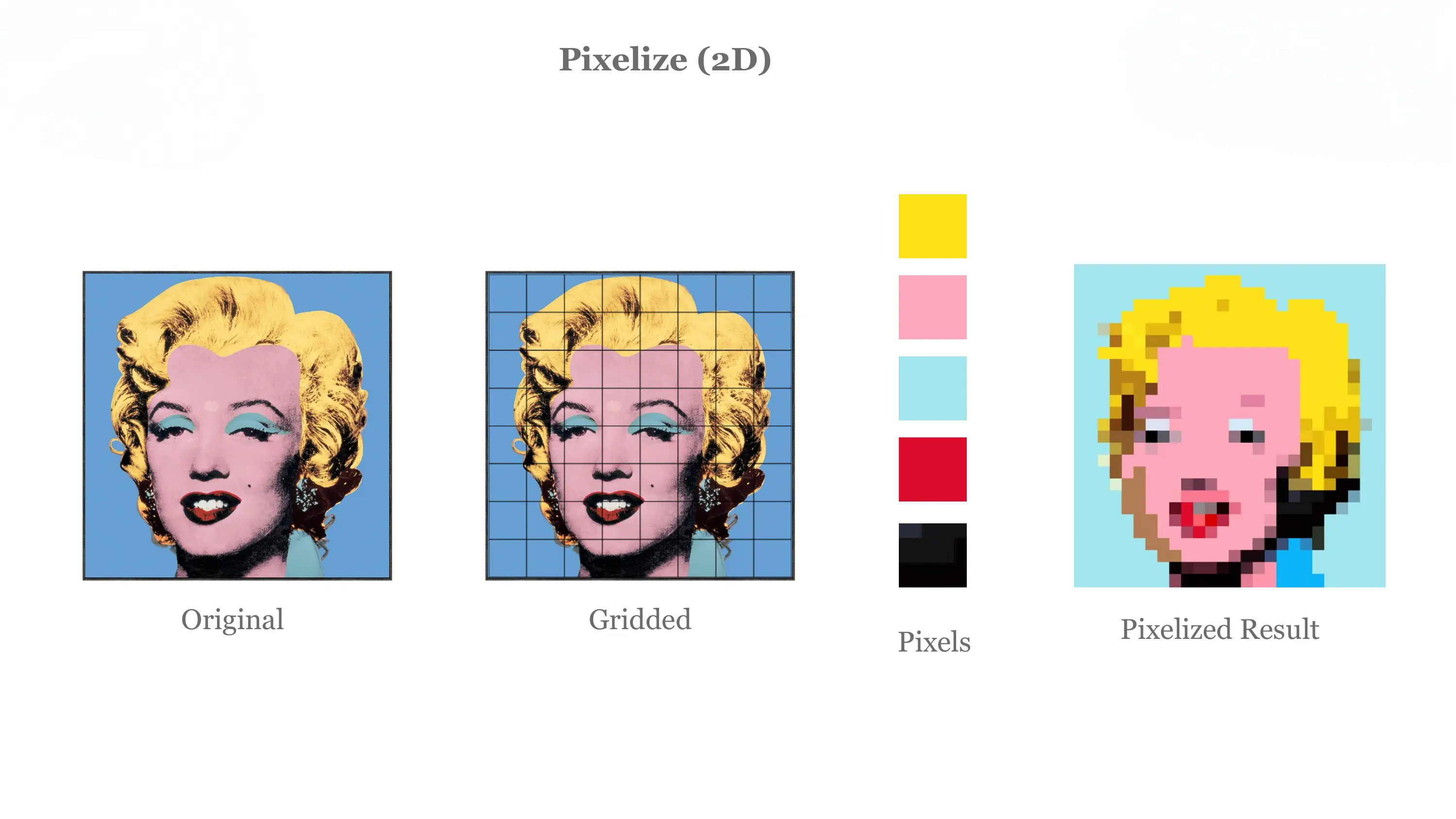
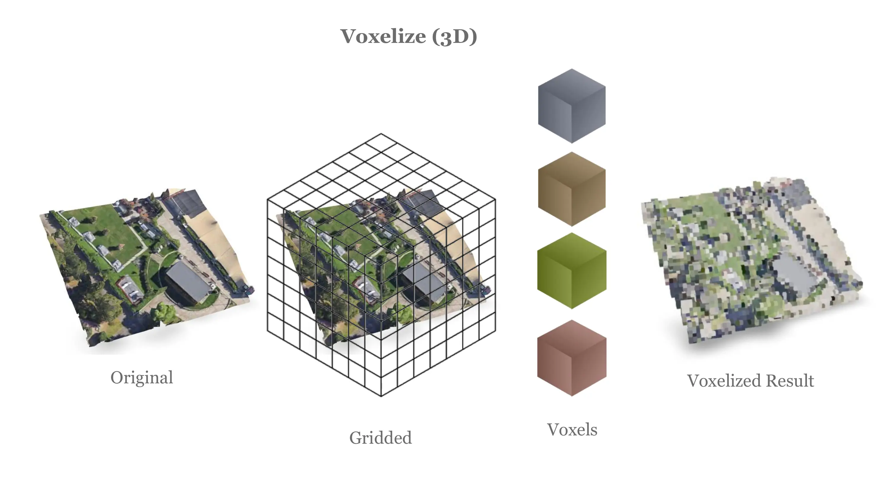
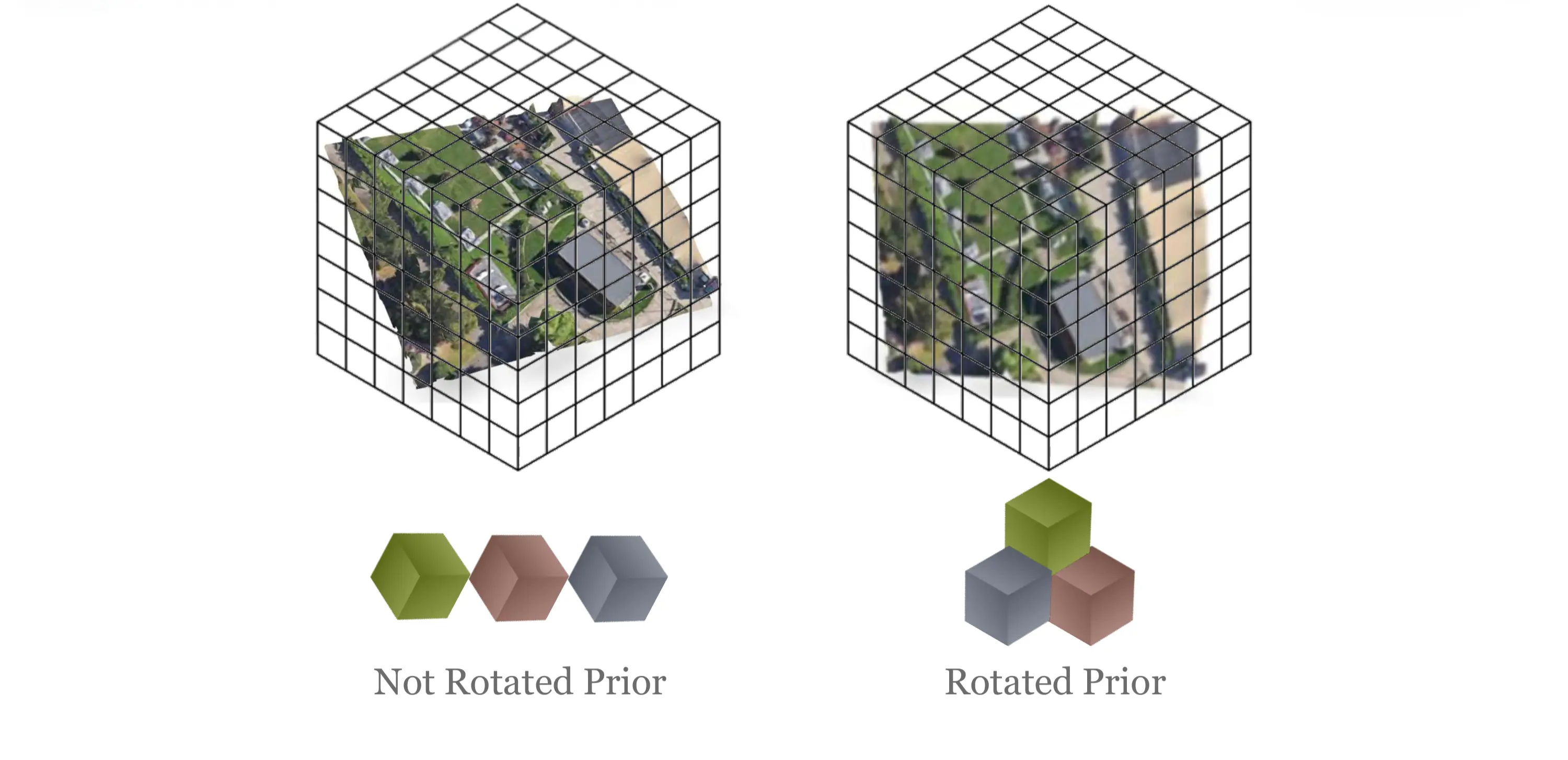
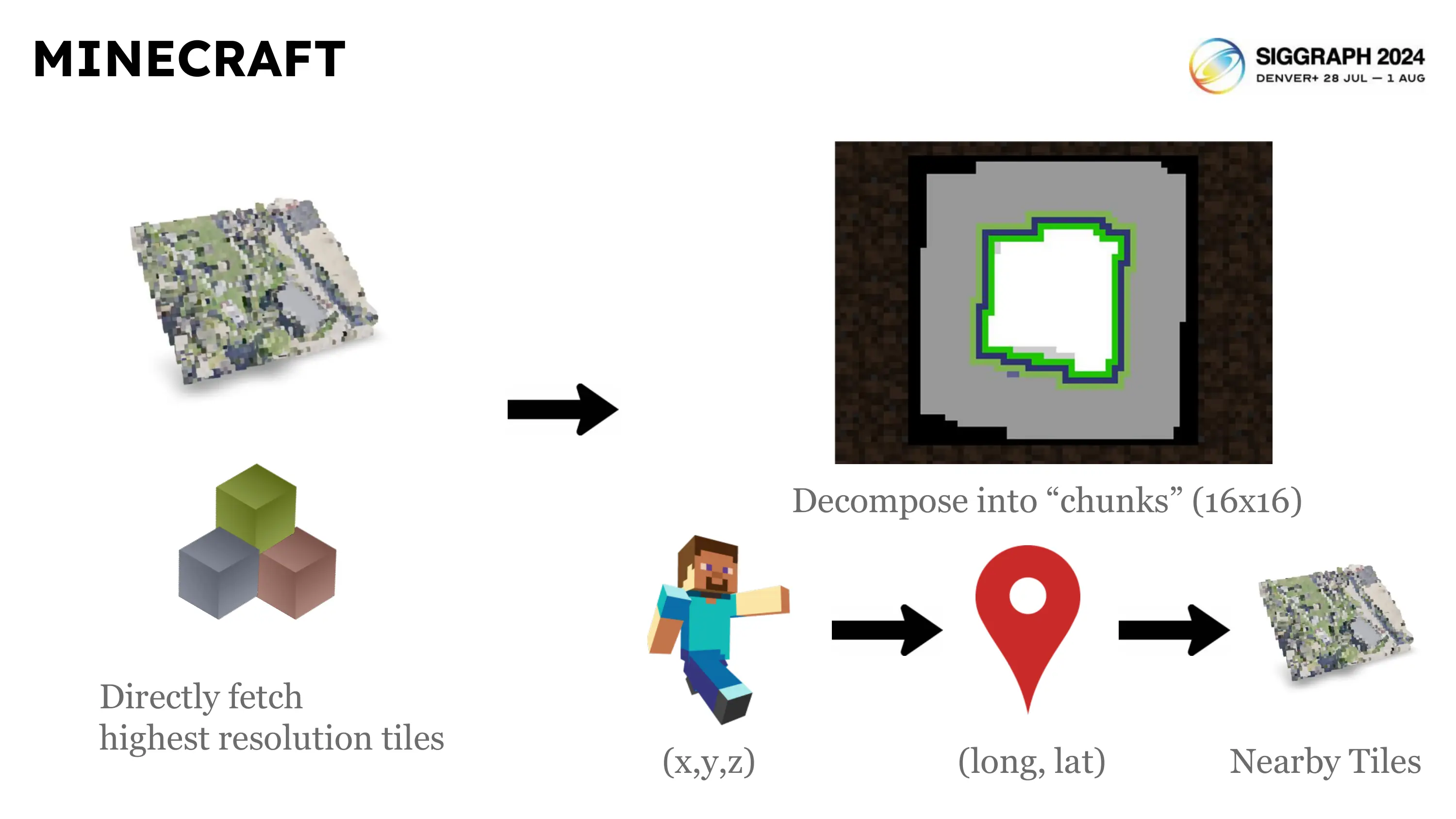
At Voxel Earth’s core is an automated pipeline that breaks down Google’s 3D Tiles into voxel grids, each voxel capturing data such as color and material. This process begins by gathering high-resolution 3D Tiles that accurately reflect real-world topography. Our pipeline then slices each tile into a seamless grid of voxels, which can be varied to different resolutions, ensuring maximum fidelity to the source material.
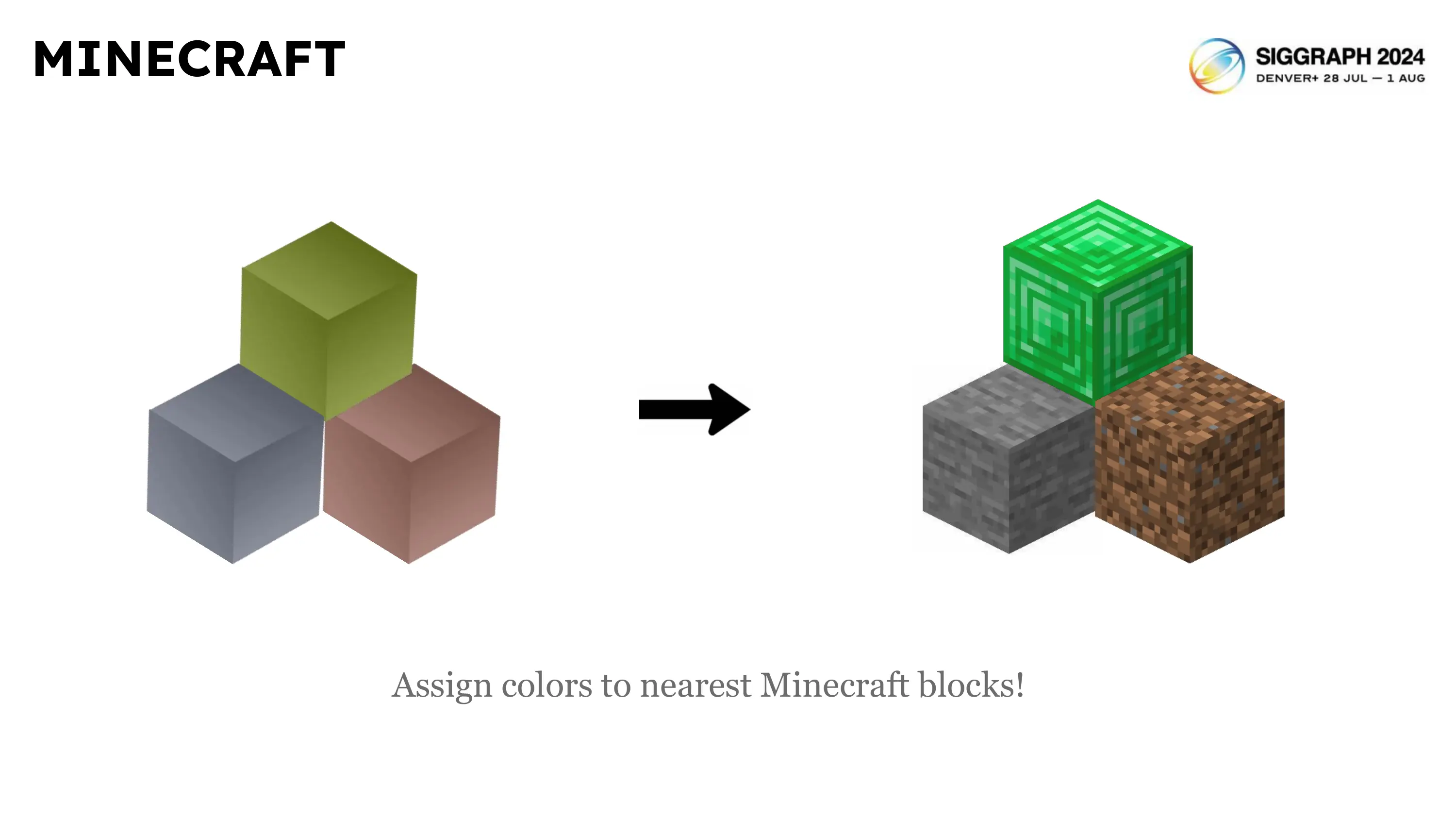
A specialized machine learning algorithm further refines these voxels into corresponding Minecraft blocks (or other voxel-based systems), preserving the original environment’s visual and contextual integrity. This is known as semantic segmentation, where we attempt to label different parts of the geospatial data, such as water or trees, into their corresponding class. For example, water areas become water blocks, vegetation turns into the appropriate flora, and buildings map to relevant structural blocks.
TECHNICAL CHALLENGES & SOLUTIONS
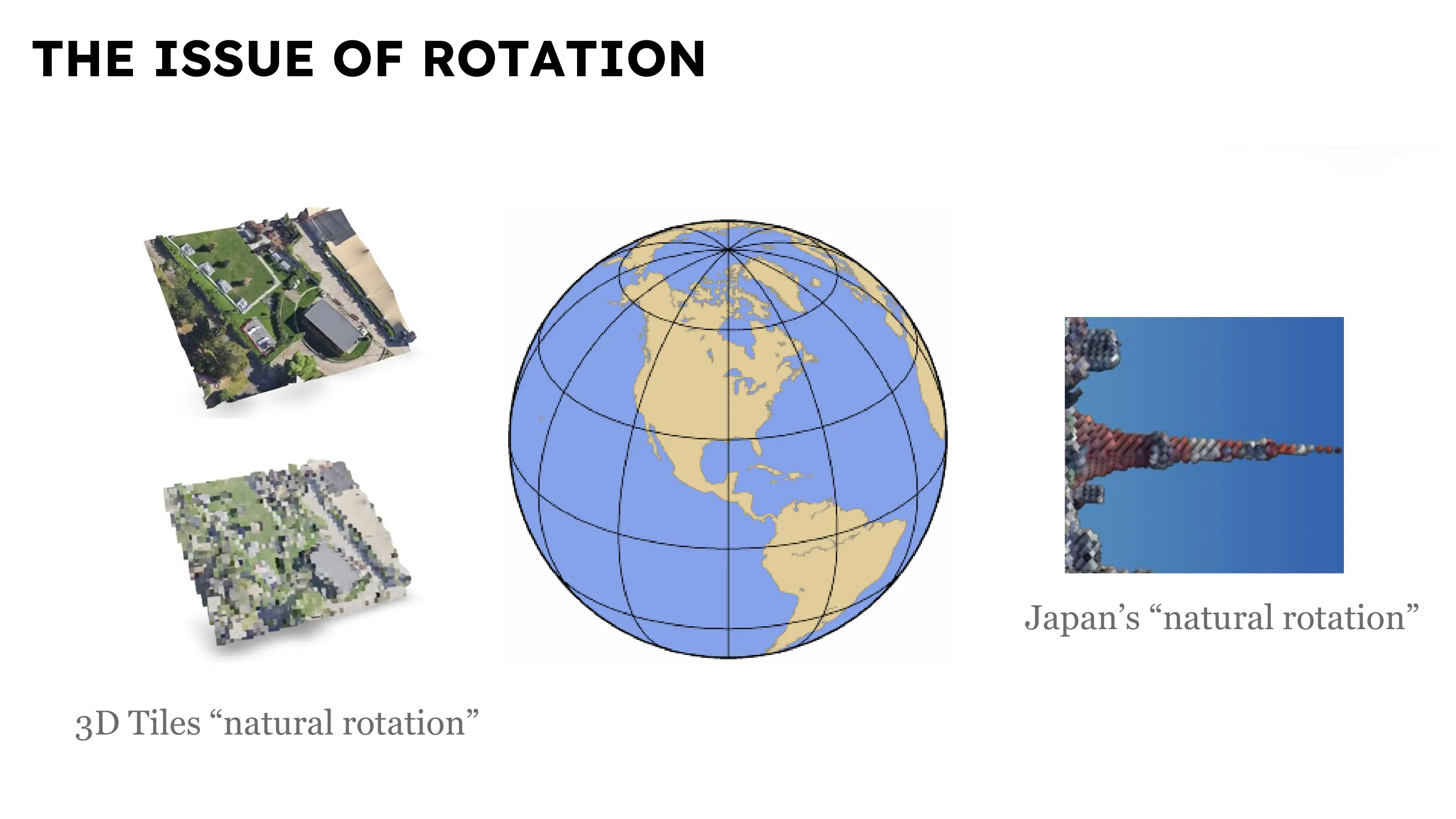
Converting Earth’s vast geospatial data into voxel form presents monumental data-processing challenges. Our approach includes parallel GPU-accelerated processing to handle enormous workloads, along with careful data compression designed for voxel structures. We also correct for the ECEF (Earth-Centered, Earth-Fixed) coordinate system, ensuring each voxel aligns precisely with real-world geometry. By continuously drawing upon Google’s on-demand 3D Tiles, we keep our voxelized world as current as possible.
MINECRAFT SUPPORT
We also offer a Minecraft plugin so users can experience real-world locations within the familiar blocky realm of the game. Want to take a stroll through your city or visit an iconic monument? You can do just that. To try it yourself, join the Minecraft server at play.voxelearth.org.
VIDEO
ACKNOWLEDGEMENTS
This project uses data from Google Maps. © 2024 Google LLC, used under fair use.
Special thanks to the Backslash Art Initiative for generously supporting our usage of the Google Maps API.